Saturday, September 5, 2015

THURSDAY & FRIDAY SEPT 3 & 4


THURSDAY & FRIDAY, SEPT 3 & 4:


      Days spent at Lassen Volcanic National Park. Both beautiful sunny days with fluffy clouds.


      We spent Thursday driving most of the length of the main national park road, which traverses from north to south for about 30 miles. Since we're staying at the north end, at a KOA campground near the town of Shingletown, we began at the north entrance.


      Our first stop was called Devastated Area – so named because when Mt. Lassen's volcano erupted in 1915, this is the path of destruction and devastation it left. There were excellent interpretive plaques along the short trail which explained what had happened, and gave the context. There were actually magma and lava build-up's and eruptions from Mt. Lassen all throughout 1914-1916. But the main event happened in 1915 . . . over a 3-day period, where the mountain finally exploded and sent boulders the size of cars flying a couple of miles away, where they sit today.


A local businessman and amateur photographer and naturalist (B.F. Loomis) captured much of the drama on film just hours before the final big explosion, which occurred after he'd, fortunately, left the area. At the time, this was the only active volcano in the contiguous U.S., and the nation was captivated. Some 60 or 65 years later, it was eclipsed by Mt. St. Helens. The plaques reminded us that we were in a very active volcanic region – the northwest U.S. being part of the Pacific “Ring of Fire.” This national park was formed out of volcanic activity, and continues to be shaped by it.


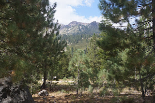
      Despite its name, the Devastated Area is lovely! The beautiful fir and pine forest surrounding us reminded us of how God designed nature to regenerate itself after devastation. All of these trees are less than 100 years old.


This area also afforded us our first real look at Mt. Lassen, from the east. Too bad all of the snow was melted by now – just in time for new snow soon!


     We left this area and continued on the road south, with more views of Mt. Lassen. 


We stopped at Helen Lake for a wondeful picnic lunch, right under the shadow of the mountain peak.


     Our last stop of the day, and the most lengthy, was at Bumpass Hell. This is the largest hydrothermal area in the national park. We walked a moderate uphill 1.5 mile trail with grand vistas of mountain peaks surrounding us,


                                               Last color of summer:


and then down a fairly steep ¼ mile or so to the hydrothermal basin.


It was very, very interesting – sort of a miniature Yellowstone – with mud pots,


  fumaroles, etc.


This whole park is fed by one thermal system . . . the volcanic mountains, the lakes, the hydrothermal features, etc. This particular area gets its name from a mountain man who guided some visistors into this area. I can't imagine what they thought when they first saw this place, with its steam gushing and roaring up, hot open vents, etc. Poor Mr. Bumpass accidentally stepped on a place where the crust was thin and his leg fell into boiling mud, which clung to his leg and burned it. He eventually had to have it amputated. We heeded the warnings to be sure and stay on the boardwalks!


But when we stopped to take a closer look and some photos, Bill leaned his walking sticks against the railing. Something disturbed them, and we watched helplessly as one slid down into its own little corner of everlasting hell!


     That's as far south as we drove on Thursday. On Friday, we drove clear to the southern end of the park, where the Visitors Center is. A beautiful drive. We hiked a 3+ mile round trip trail which begins just behind the Visitiors Center to Mill Creek Falls, the highest waterfall in the park.


It was rated moderately strenuous, so we felt good about having accomplished it! We hiked through a lovely forest of red fir, pines, and some mountain hemlock, with some splendid views of surrounding peaks and valleys. 


Even saw a couple of deer grazing.


On the drive home, stopped at calendar-perfect Summit Lake.


     Although we only spent two days here, we got a really good feel for the park and felt that we saw and experienced the highlights. Because Lassen Nat'l Park lies at the crossroads of two mountain ranges (Cascades to the north, Sierra Nevada to the south), and the Great Basin desert to the east, there's a great diversity of ecosystems and flora and fauna within its borders. On our park drives, we not only went through a variety of altitudes (from 5,000 to over 8,000 feet), but saw the evidence of different ecosystems – especially the types of trees. It's a small, lesser known national park, but we're glad we took the time and effort to get here.


Wednesday, September 2, 2015

WEDNESDAY, SEPT 2


WEDNESDAY, SEPT 2:


      After a last breakfast with Lynn, she left and we followed suit shortly thereafter. We both took Hwy 199 north, but when we arrived at Grants Pass Oregon, she went north on I-5 to Portland, while we turned south. It was deja vu for us up to that point, as 199 North was the route we took last year to get to Grants Pass and our white water rafting trip (and thence to Crater Lake and north into Oregon & Washington). We recollected how we came down the Oregon coast on Hwy 101 last year, but to get east of there at the southern end of Oregon's coast, you had to dip down into northern Calif – Crescent City – and take 199 north back into Oregon. We reminisced about how totally surprised and delighted we were to discover that we were in the Redwoods. We had a taste of them last year, and a “full course” of them this year. We feel really fortunate to have been able to spend as much time with them as we did. Stately, majestic, noble and heroic, yet unassuming, they evoke a myriad of feelings and responses when you're in a forest of them, or surrounded by them on a narrow roadway: awe, mystery, hushed silence, sometimes a feeling that you're transported back to a primeval epoch. It's a feeling that no other type of forest brings forth . . . at least that's how it was for us.


     No real trouble on the 280 miles to Lassen, even with the highest pass on I-5 (Siskiyou Summit). In the lower Cascades now. Had beautiful views of Mt. Shasta, still with visible snow on top this late in the year, and of Lake Shasta, sadly only half full.


     After we turned off the I-5 at Redding onto state Hwy 44, there were some dicey uphill grades there, which wasn't surprising, since Lassen National Park ranges in elevation from some 5,000 feet to its highest peak at over 10,000 ft. But, in spite of some engine protests, the truck made it fine.
Thanks for answered prayers.
     Another lovely, wooded campground. Widely, natural spaced sites. Very few people here, and so very quiet. But that will change with the Labor Day weekend coming up. As of now, we couldn't book a site for Sat & Sun nights. But there may be some cancellations, and we may luck out.


Tuesday, September 1, 2015

SUNDAY – TUESDAY, AUGUST 30-SEPT 1:


SUNDAY – TUESDAY, AUGUST 30-SEPT 1:


      Rained again Sat. night and Sunday morning. Welcomed, in that it will help with the awful forest fires which have been raging in northern Calif and eastern Oregon and Washington most of the summer. With the drought, the forests are a tinderbox, and it's been the worst fire season in recent memory. However, it has rarely affected us, for which we're thankful.


      Lynn arrived late Sunday afternoon, and we enjoyed a lovely grilled salmon dinner outside. A little chilly, but fine with jackets. In fact, the two of us stayed outside sipping wine and talking for quite a while after dinner.


      As predicted, Monday dawned bright and sunny. What a glorious day for a walk in the woods! After a leisurely breakfast, we drove again into the Jedediah Smith Park, but this time took a back road. VERY back road – narrow, twisty, rough, and not paved. But oh, the scenery! Hemmed in by huge majestic redwoods on either side. We stopped a few miles up the road at the Boy Scout Trail, and the 3 of us embarked on it. Once again surrounded by awe-inspiring old growth redwood forest. I don't think one could ever tire of seeing this!


     Bill decided to turn back after about a mile; Lynn & I kept going for probably at least another mile, if not more – and this part was more challenging – twisty, up and down. We calculated that we weren't far from the trail's end (2.6 mies), at a waterfall. But I'd read that the waterfall was nothing special at all – really, just a splash of the stream over an embankment. And we were getting a little fatigued, so turned back. A nice workout on this trail categorized as “moderate,” in glorious weather.


      Rested and cat-napped back at the RV before grilling shrimp on the grill. Another yummy dinner that we all enjoyed. 


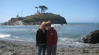
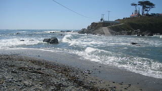
      A second beautiful day on Tuesday. We drove down to the Battery Point Lighthouse. No tours today because of the tides – apparently very high tides most of the day. But it was fascinating to watch the tide come in - from both sides, and totally fill the space in between where we had walked just the other day.


As the tide rose, naturally the waves became more vigorous, and after a while, waves from both sides were crashing into each other. Surely wouldn't want to have a reason to need to get to the lighthouse now!


     Then quickly rode over to the harbor and enjoyed the sea lions and their antics for a few minutes.


     And then drove on out Pebble Beach Drive, which skirts the ocean for a few miles. A gorgeous drive on this beautiful day. 


 A few miles north of town is St. George Point. This is named for the St. George Lighthouse, which is 6 miles offshore. We could faintly see it, off in the distance.


It was the last lighthouse to be built, completed in 1892, as a direct result several years earlier of the shipwreck in that area of the Brother Jonathan, a ship which had just left the Battery Point area with 200 passengers. It hit an uncharted rock, and all but 11 people perished. So this additional lighthouse was built at the astronomical cost of $700,000 back then (equivalent to $19 million today), taking 10 years to build the 15-story structure. It was the most dangerous assignment for a lighthouse keeper, due to its isolation and vulnerablity to the unpredictable and treacherous sea all around it. For example, supplies were carried in by boat, and the entire boat would be hooked to a large boom and then lifted to a boat deck at the base of the caisson (concrete and granite base of the tower). During this transfer process, 4 men and 1 dog lost their lives over the years. The lighthouse was decommissioned in 1975, and its 8-foot high first order Fresnel lens was removed and donated to the historical society in Crescent City.

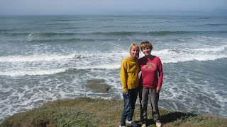
      We picnicked on a bluff overlooking the absolutely gorgeous water this afternoon. All 3 of us were mesmerized by the rhythmn of the waves crashing below us, the spray against the rocks, the white foam.


It was especially hard for Bill and me to leave this spot, as it is the last time we'll see the ocean on this trip. From San Diego all the way up the California coast, we've been exposed to the coastline and water. From the warm sandy beaches in Oceanside to the spectacular cliffside ocean along Big Sur to the powder-blue scalloped-edged coastline of the Oregon border. And we always thought we weren't that spell-bound by the ocean! Wrong!
     So tomorrow Lynn will head back to Portland, and we'll head south and east to Lassen National Park. - 1st stop on our way back home. Will stay there 3 nights, then a little more south and east to the Sierras for a short time.


SATURDAY, AUGUST 29


SATURDAY, AUGUST 29:


      Rained – sometimes hard - last night. Maybe it'll help settle some of the dust here in the campground, as well as help put out some of the fires up in this area. 


      After a relaxed morning, we headed into town again with our bikes in tow. Parked the truck by the Battery Point Lighthouse and started on the bike path there.
 
 
                                        Path up to the lighthouse covered over now at high tide:


 It wasn't long – maybe a couple of miles 1 way, and led out to the harbor area. It was mostly mostly cloudy, chilly, and windy, but despite that, it was a very nice little ride and a good way to see the harbor. We had fun watching up close the sea lions on a couple of big rocks close to the road.
 
                                                                   
     When the clouds gave way, we admired the surf. The wind was constantly pushing small but pretty waves up. The color was lovely. Reminded us a little of coming down the Oregon coast last year.


   Found out that Lynn will be driving down from Portland to stay with us for a couple of days. Excited!