THURSDAY
& FRIDAY, SEPT 3 & 4:
Days
spent at Lassen Volcanic National Park. Both
beautiful
sunny days with fluffy clouds.
We
spent Thursday driving most of the length of the main national park
road, which traverses from north to south for about 30 miles. Since
we're staying at the north end, at a KOA campground near the town of
Shingletown, we began at the north entrance.
Our
first stop was called Devastated Area – so named because when Mt.
Lassen's volcano erupted in 1915, this is the path of destruction and
devastation it left. There were excellent interpretive plaques along
the short trail which explained what had happened, and gave the
context. There were actually magma and lava build-up's and eruptions
from Mt. Lassen all throughout 1914-1916. But the main event
happened in 1915 . . . over a 3-day period, where
the mountain finally exploded and sent boulders the size of cars
flying a couple of miles away, where they sit today.

A
local businessman and amateur photographer and naturalist (B.F.
Loomis) captured much of the drama on film just hours before the
final big explosion, which occurred after
he'd,
fortunately,
left the area. At the time, this was the only active volcano in the
contiguous U.S., and the nation was captivated. Some 60 or 65 years
later, it was eclipsed by Mt. St. Helens. The plaques reminded us
that we were in a very active volcanic region – the northwest U.S.
being part of the Pacific “Ring of Fire.” This national park was
formed out of volcanic activity, and continues to be shaped by it.
Despite
its name, the Devastated Area is lovely! The beautiful fir and pine
forest surrounding us reminded us of how God designed nature to
regenerate itself after devastation. All of these trees are less
than 100 years old.

This
area also afforded us our first real look at Mt. Lassen, from the
east. Too bad all of the snow was melted by now – just in time for
new snow soon!

We
left this area and continued on the road south, with more views of Mt. Lassen.


We stopped at Helen Lake for a wondeful picnic lunch, right under the shadow of the mountain peak.


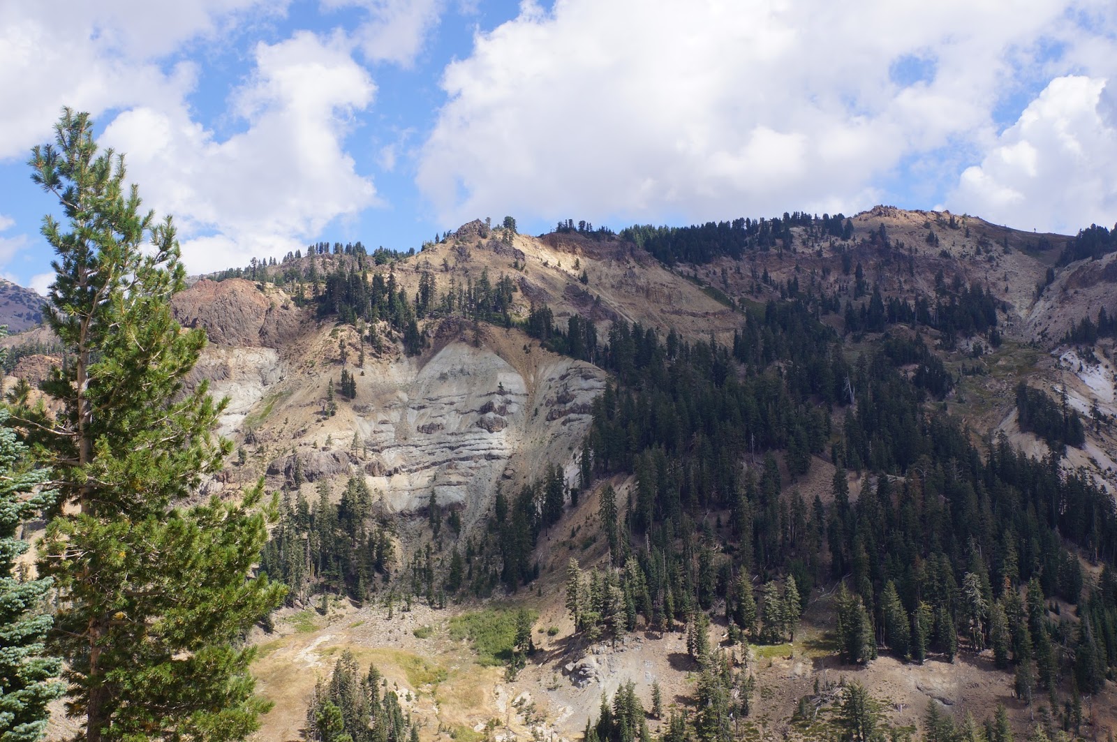
Our
last stop of the day, and the most lengthy, was at Bumpass Hell.
This is the largest hydrothermal area in the national park. We walked
a moderate uphill 1.5 mile trail with grand vistas of mountain peaks
surrounding us,

Last color of summer:


and
then down a fairly steep ¼ mile or so to the hydrothermal basin.


It
was very, very interesting – sort of a miniature Yellowstone –
with mud pots,


This
whole park is fed by one thermal system . . . the volcanic mountains, the lakes,
the hydrothermal features, etc. This particular area gets its name
from a mountain man who guided some visistors into this area. I
can't imagine what they thought when they first saw this place, with
its steam gushing and roaring up, hot open vents, etc. Poor Mr.
Bumpass accidentally stepped on a place where the crust was thin and
his leg fell into boiling mud, which clung to his leg and burned it.
He eventually had to have it amputated. We heeded the warnings to be
sure and stay on the boardwalks!

But
when we stopped to take a closer look and some photos, Bill leaned
his walking sticks against the railing. Something disturbed them,
and we watched helplessly as one slid down into its own little corner
of everlasting hell!

That's
as far south as we drove on Thursday. On Friday, we drove clear to
the southern end of the park, where the Visitors Center is. A
beautiful drive. We hiked a 3+ mile round trip trail which begins
just behind the Visitiors Center to Mill Creek Falls, the highest
waterfall in the park.


It
was rated moderately strenuous, so we felt good about having
accomplished it! We hiked through a lovely forest of red fir, pines,
and some mountain hemlock, with some splendid views of surrounding
peaks and valleys.


Even saw a couple of deer grazing.

On the drive home, stopped at calendar-perfect Summit Lake.

Although
we only spent two days here, we got a really good feel for the park
and felt that we saw and experienced the highlights. Because
Lassen Nat'l Park lies at the crossroads of two mountain ranges
(Cascades to the north, Sierra Nevada to the south), and the Great
Basin desert to the east, there's a great diversity of ecosystems and
flora and fauna within its borders. On our park drives, we not only
went through a variety of altitudes (from 5,000 to over 8,000 feet),
but saw the evidence of different ecosystems – especially the
types of trees. It's a small, lesser known national park, but we're
glad we took the time and effort to get here.
No comments:
Post a Comment